SPARTAN
Customizable, cost-effective professional aerial mapping drone designed
for professionals who need precision without the complexity of
high-end enterprise solutions.
DESIGNED FOR EFFICIENCY. BUILT FOR THE FIELD.

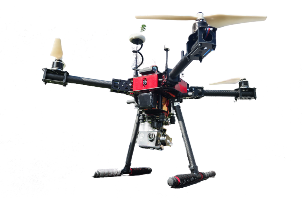
4K CAMERA PAYLOAD
for capturing sharp, high-resolution aerial

COLLAPSIBLE BOOMS
for portability and ease of transport

FPV CAMERA
enhancing pilot control and situational awareness
GENERAL SPECS
| Max Payload | 1.5 lbs |
| Diagonal Wheelbase | 22 in (560 mm) |
| Folded Dimensions | 11 x 11 x 12 in (28 x 28 x 30 mm) |
| Propeller Size | 9.5 in |
| Maximum Take-Off Weight | 5.5 lbs |
| Maximum Thrust | 12 lbs |
| Maximum Flight Capacity | 25 min |
| Battery Capacity | 4s 6,500 mAh |
| Gimbal Weight | 0.6 lbs |
INDUSTRY APPLICATIONS
| INDUSTRY | APPLICATIONS |
|---|---|
| Agriculture | Crop monitoring, Yield optimization |
| Construction | Progress tracking, Topographic surveys |
| Real Estate | 3D mapping, Site visualization |
| Environmental | Land change detection, conservation |
SEAMLESS SOFTWARE CAPABILITY

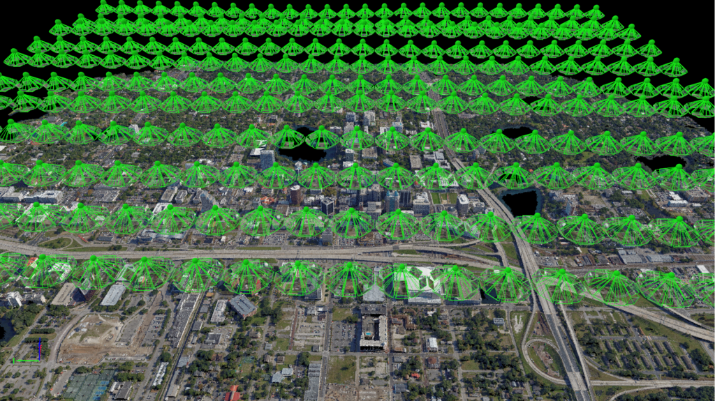
Spartan is designed to integrate with industry-leading mapping and surveying software, ensuring flexibility for your workflow. Whether you’re generating high-resolution orthomosaics, 3D models, or detailed site maps, Spartan works seamlessly with:
✅ DroneDeploy – Cloud-based mapping and analysis
✅ Pix4D – Advanced photogrammetry and 3D modeling
✅ Propeller Aero – Survey-grade accuracy for construction and mining
✅ Agisoft Metashape – High-precision photogrammetry processing
✅ Site Scan for ArcGIS – GIS integration for real-world applications
✅ Delair.ai – AI-powered asset and infrastructure analysis
While Spartan is sold as a standalone drone, we plan to offer drone-and-software packages in the future. Stay tuned for bundled solutions that fit your industry needs!

CUSTOMIZABLE. COST EFFECTIVE.
READY TO FLY.
ORDER SPARTAN TODAY.